
Parma Heights ZIP Code Coverage
Only one local ZIP fact is verified in the inspected sources: 44130. Official city, Building Department, police-records, and Parma Heights Branch Library addresses all use Parma Heights, OH 44130. That repeated pattern makes it the principal verified postal clue for the city. It does not establish that every address inside the municipal boundary uses that ZIP, or that every 44130 delivery location falls inside the city. Postal routing and municipal jurisdiction are different systems.
| ZIP | Areas Covered | Post Office | Notes |
|---|---|---|---|
| 44130 | Official local agency addresses labeled Parma Heights | Not identified in the inspected official local sources | Verify each delivery address with USPS; a ZIP is not a city boundary |
| Additional ZIPs | Research gap: no official local coverage was located | Not verified | Do not infer coverage from a map label or a nearby community address |
The additional-ZIP row is deliberate. No inspected official source documented another ZIP serving Parma Heights, a local post-office boundary, a PO-box-only ZIP, or a ZIP realignment. Do not expand this Parma Heights ZIP code directory with an unverified number. Use the postal result for the exact address, then retain the city, parcel, and election labels separately.
Note: A verified 44130 address confirms a postal label for that address, not the municipal limits, property parcel, or election district.
USPS and Parma Heights ZIP Codes
For Parma Heights, the official USPS ZIP Code Lookup is the correct starting point for an exact delivery address. Enter a non-sensitive street address, review the returned mailing format, and retain that format as postal normalization. A USPS answer validates a delivery address. It does not identify a parcel owner, establish a court jurisdiction, or replace the county's parcel record. Keeping that narrow purpose visible makes a ZIP code directory useful without turning it into a person search.
- Enter the complete street number, street name, unit when applicable, city label, and state in the USPS address tool.
- Record the postal form returned for that exact address, including the ZIP or ZIP+4 when USPS supplies it.
- Use the normalized street address in MyPlace or the Recorder only after confirming the city and street elements still match.
- Label the USPS result as postal information when comparing it with property, permit, or election records.
Delivery information can be useful for cleaning an address before a record search. It cannot create a verified list of people within a ZIP. The county property route and election route use their own fields, each with a different level of geography.
Parma Heights Records Without ZIP Filters
The main local systems examined do not offer a Parma Heights ZIP filter. MyPlace uses City plus Owner, Parcel, or Address modes. The Recorder accepts party, date, document, Parcel ID, property address, and legal-description searches. Ohio Voter Search requires first name, last name, and county. This changes the right workflow: use a ZIP only to confirm a delivery address, then move into the field the record system actually supports.
| System | Verified fields | Use after a ZIP check |
|---|---|---|
| MyPlace | City, Owner, Parcel, Address | Select Parma Heights, search address or parcel, then save the Parcel ID. |
| Recorder advanced search | Party, date, document, Parcel ID, property address, legal description | Use the exact address or dashed Parcel ID to find an instrument. |
| Ohio Voter Search | First name, last name, county | Use Cuyahoga County for an individual registration check, not a ZIP list. |
MyPlace is a free public service, not the controlling official record. It provides a City selector, a View Map action, a clickable Parcel ID, and tabs that can include transfers, values, permits, and tax by year. A county parcel display can show a situs or property presentation alongside a separate mailing context. Those fields should remain labeled as the portal presents them.
The Recorder quick search also has recorded-date fields and a choice between index-only searching and index-plus-full-text OCR. OCR can help locate words or phrases, but the underlying indexed document and image remain the place to verify a party name, recorded date, legal description, and Parcel ID. None of those fields becomes a ZIP search just because a postal address was used as the starting clue.
Note: A ZIP may help normalize an address, but it does not add a filter to a portal that lacks one.
Parma Heights ZIP Code Workflow
A ZIP code can narrow the postal question, but an address or parcel drives the local record search. For a Parma Heights address, verify the mailing form with USPS first. In MyPlace, set City to Parma Heights and choose Address or Parcel. Once a parcel appears, copy the Parcel ID. The Recorder's advanced route accepts a property address or Parcel ID, with a visible dashed identifier format. That sequence connects delivery information to the county records that can actually be searched.
- Confirm the full delivery address in USPS, without treating the result as a municipal or parcel conclusion.
- Choose Parma Heights in MyPlace and run the Address mode, or enter a known Parcel ID.
- Save the parcel identifier and compare the situs, mailing, and transfer fields as separately labeled facts.
- Search the Recorder by exact address or dashed Parcel ID when a recorded document is the question.
- Shift to the Parma Heights street directory only when the task becomes an address-led street record trail.
A deed's legal description may not match a mailing address word for word. Link it through the Parcel ID and the document list instead of forcing a ZIP code to bridge records it was never designed to connect.
Parma Heights Parcel Delivery Fields
Four address-like fields can point to different things. A USPS delivery address is a postal routing result. A situs address identifies the physical property presentation used in a county property record. A mailing address is where county notices go. A permit row can also identify an applicant, contractor, business, or parcel. The field labels are evidence of distinct administrative purposes, not proof that all the values describe the same person or place at the same time.
Use the Parcel ID as the county bridge. The Recorder expects that identifier with dashes in the 999-99-999 style. Where an instrument uses a subdivision, lot, or legal description rather than a street form, compare the parcel/document list and historical map material. That method protects a Parma Heights ZIP code lookup from becoming a misleading address match.
Parma Heights Election Geography
Election records are organized by county, city, ward, precinct, polling location, ballot, and district rather than by ZIP. Ohio Voter Search requires the person's first name, last name, and county. The Cuyahoga Board of Elections provides voter-facing city, ward, precinct, polling-place, ballot, district, and declared-party information. Those results can change with an election cycle or redistricting, so preserve the election date when using them as a record reference.
The Cuyahoga County Board of Elections provides county election resources and the local public-record route.
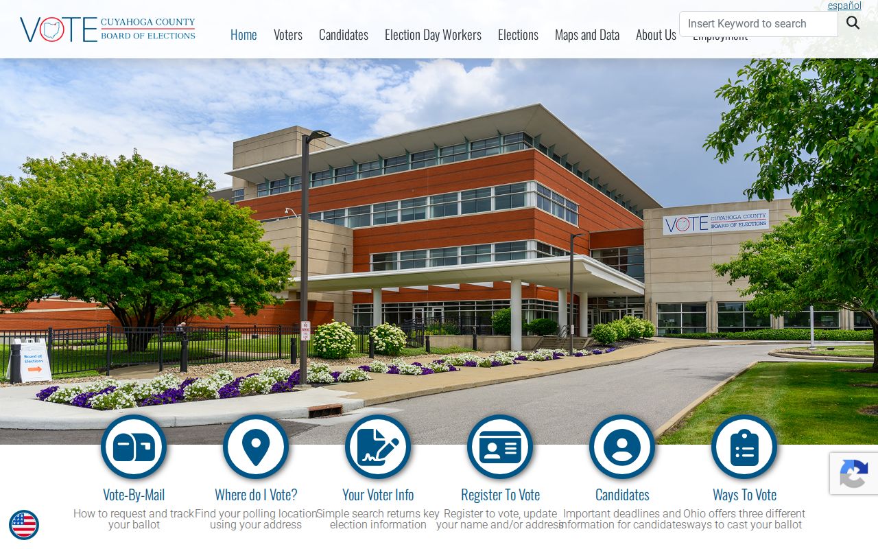
County election resources use election geography, which is why a postal ZIP cannot replace the city, ward, or precinct elements of a request.
The Board of Elections voter information shows the county's voter-service context.
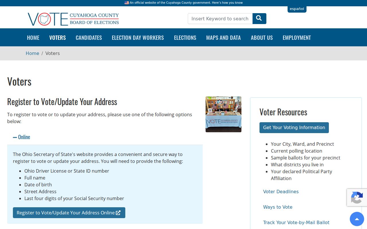
For an existing election record, name the record type, election date, and geographic scope instead of requesting a ZIP-based resident list the public tool does not offer.
Parma Heights ZIP Boundaries
Parma Heights is a municipality in Cuyahoga County, not a postal zone. The local geography research explains that the city separated from Parma Township in 1911 and became a city in 1959. It is bounded by Brook Park and Middleburg Heights to the west and Parma on its other sides. Those facts describe municipal context. They do not draw a USPS delivery boundary, yet they explain why a city selector in county property research can be more meaningful than a ZIP alone.
The Encyclopedia of Cleveland History entry for Parma Heights provides the city-history and adjacent-municipality context.
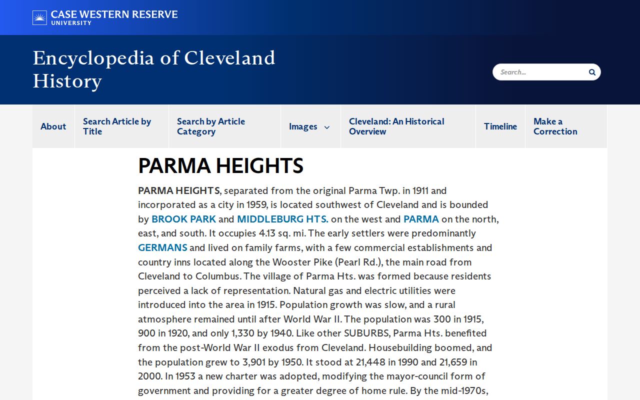
Historic collection titles may say Parma Township, Parma, Parma Heights, or West Suburban, so record year and jurisdiction matter when an older address result is missing.
The Census QuickFacts table for Parma Heights supplies the city-area context used in this distinction.
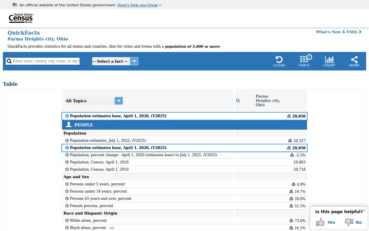
The city's 4.2-square-mile Census area is civic context, not a postal map. Keep a city limit, a Census area, and a ZIP result in their respective systems.
Note: Cite municipal, Census, and postal sources separately when an address search crosses one of those boundaries.
Parma Heights ZIP Code Terms
Postal terms can look like property terms but work differently. Defining them before comparing records helps preserve the right level of certainty for a Parma Heights ZIP code directory search.
- ZIP code
- A postal routing code attached to a delivery address, not a municipal boundary or parcel identifier.
- ZIP+4
- An added postal segment that USPS may return for a more specific delivery point or range.
- PO-box ZIP
- A ZIP used for post-office boxes. No such Parma Heights ZIP was verified in the inspected sources.
- Unique ZIP
- A ZIP assigned to one organization or delivery use. None was verified here for Parma Heights.
- Carrier route
- A postal delivery grouping, not a city ward, precinct, or county parcel boundary.
Parma Heights ZIP Code Limits
The Cuyahoga County government context is countywide, while a ZIP result is postal and a MyPlace result is parcel-focused. County material, city material, and USPS answers should be cited for the question each controls. No official ZIP layer was verified in the accessible county map source, and no ZIP field was observed in MyPlace, the Recorder, or Ohio Voter Search. That is a research boundary, not evidence that those systems share a hidden ZIP geography.
The Cuyahoga County government is the county-level context for the property, Recorder, and election offices used in this workflow.
When an exact mailing question remains uncertain, return to USPS with the full address and leave unverified extra-ZIP or post-office claims out of the record trail.
The county Advanced Map entry point is public, but the inspected material did not expose a verified ZIP-layer legend or a direct parcel-map permalink field. Use a map as a way to inspect a selected parcel after the address or Parcel ID search. Do not turn a visible polygon, nearby city label, or map color into a claim about postal coverage.